

|
Published: 5 November 2012
Damage to farms minimal under Basin plan: scientists
Scientists from the University of NSW (UNSW) have found that the impact of environmental flows on farmlands and nature reserves around the Murray-Darling Basin will be minimal to farming and other land use areas in the Basin. The flows are designed to mimic natural flooding processes and improve ecological health.
|
|
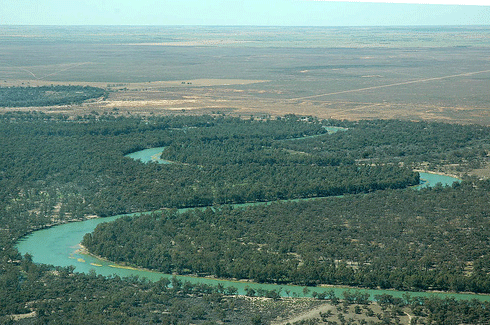
Environmental flows are not only critically important to the ecosystem, but also to agriculture, as they provide good water quality, healthy rivers and benefits for grazing communities. Credit:
CSIRO
|
‘We found that, even with widespread flooding, most of the areas affected are floodplain areas, which are primarily used for grazing livestock,’ said lead author Professor Richard Kingsford, Director of the Australian Rivers, Wetlands and Landscapes Centre at UNSW.
‘Usually these landholders welcome floods as they rejuvenate floodplains and provide increased benefits to livestock.’
Using satellite imagery, the researchers examined the maximum flooding and floodplain area in the Murray Darling Basin, including 62,164 km2 of wetland, which covered 5.87 per cent of the land area of the entire Basin. These wetlands included all rivers, lakes, swamps and floodplain areas that were inundated fully during a ten-year period (1984-1993).
‘These figures, representing maximum estimates of impact, clearly show that environmental flows are unlikely to have widespread impacts on agriculture across the Murray-Darling Basin,’ said Professor Kingsford.
‘In fact, it is important to acknowledge that environmental flows are critically important to agriculture, providing good water quality, healthy rivers and benefits for grazing communities’.
Key findings of the study, funded by the Australian Floodplain Association, included:
-
Only 4.77 per cent of wetland area encroached on irrigation areas; only 5.44 per cent occurred in protected areas.
-
Most of the flooded area in the Basin consisted of a range of other land uses (89.79 per cent).
-
More than half of this other land use (52.64 per cent) was categorised for grazing, either in woodland or naturalised pasture; remaining land was not categorised or urban.
-
These grazing categories were the main land use in more than 50 per cent of wetlands in 17 of the 25 catchments of the Basin.
-
When all wetlands on agricultural land were included (i.e. agricultural cropping, grazing, unallocated agricultural land), flooded land was predominantly in grazing areas (84.28 per cent) in the Basin.
-
Of the 25 river catchments in the Murray-Darling Basin, percentage areas of wetlands in irrigation areas were generally low: eight catchments had none; three had less than 1 per cent; seven had less than 5 per cent; and 5 per cent had 5-20 per cent.
Source: UNSW

