

|
Published: 2 December 2014
National digital soil map opens window to better landscape management
Australia’s vast, complex land surface is now represented in a ‘digital tapestry’ thanks to the development of a new comprehensive set of national soil and landscape maps.
|
|
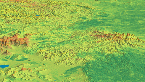
Total nitrogen in the top 0–5 cm of Australian soils, from the Soil and Landscape Grid of Australia. Credit: CSIRO
|
The country is represented as a digital grid of two billion pixels – each about 90 x 90 metres in area – with soils mapped to a depth of two metres below the surface.
The Soil and Landscape Grid of Australia is the result of a partnership between CSIRO, the University of Sydney, federal, state and territory government agencies and the Terrestrial Ecosystem Research Network (TERN).
The grid weaves together historical and current data from sampling, laboratory sensing, modelling and remote sensing activities by partner agencies.
Soil attributes such as soil water, nutrients and clay affect the sustainable management of the landscape as well as the profitability of sectors such as agriculture, mining and infrastructure.
‘We need better ways to make this diverse information available; new science and technology has let us make the most of the rich data we have,’ said CSIRO researcher, Mike Grundy.
‘From exploring new land use options, to making the most of water, to finding habitats for endangered native species, this technology has applications we are only just beginning to imagine.’
The grid will be beneficial to a range of end-users including urban and regional planners, land managers, farming groups, scientists and engineers.
Alexandra Gartmann, CEO at Foundation for Rural & Regional Renewal and former CEO of Birchip Cropping Group, has worked with rural industries for almost two decades. Ms Gartmann said she was excited by the new technology.
‘Knowledge is power, and our agricultural industries have a very narrow margin for error these days, so the more knowledge to reduce poor decisions, the better,’ Ms Gartmann said.
‘The Soil and Landscape Grid is a huge leap forward. With its national datasets and consistent and comparable data, it has huge potential for regional development, informing planning and decision making.’
Source: CSIRO

