Print this page

Published: 2009

Eyre Peninsula: added protection and eco-tourism project


Efforts to safeguard the near-pristine Eyre Peninsula in South Australia (Ecos 149, p. 18) saw two notable developments in recent months.

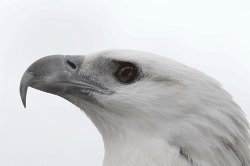
The white-bellied sea eagle is one of the rare and endangered species found on the Eyre Peninsula.
Credit: Grant Hobson

In a move welcomed by conservation groups, the state government bought 10 parcels of land on the peninsula to help protect rare and endangered wildlife, including the white-bellied sea eagle, osprey and Australian sea lion.

The new coastal conservation areas between Cape Blanche and Slade Point and sand dunes on the northern side of Searcy Bay will add 1400 hectares to the existing parks and reserves between Streaky Bay and Venus Bay.

The state’s Environment and Conservation Minister, Jay Weatherill, said protecting key areas ‘will encourage sustainable tourism and appropriate coastal management’.

As well as purchasing freehold land, the government announced it will allocate Crown Land to augment the existing parks and reserves system. For example, land surrounding Baird Bay will be joined to the Baird Bay Islands Conservation Park to form a Baird Bay Conservation Park.

The Department for Environment and Heritage will also open an office in Streaky Bay and appoint a District Ranger to oversee the conservation areas.

Soon after this announcement, however, a proposed eco-tourist village at the Eyre Peninsula’s Cape Bauer was declared a major development, a year after the state government had rejected a similar application.

According to the South Australian Urban Development and Planning Minister, Paul Holloway, the development – about 15 kilometres north-west of Streaky Bay – has been declared ‘major’ because the fragile cliff-top environment warrants the level of scrutiny afforded to major projects.

The current plan is for a tourist village on 150 hectares, along with restoration of more than 700 hectares of dunes and scrub. The minister said the resort would make ‘much better use of what is now agricultural land’.

The eco-resort will include conference facilities, a restaurant, a swimming pool, a shop, 12 hotel/motel style rooms, 22 ‘coastal villas’ and 30 owner-occupied holiday homes. The proposal also seeks to create 300 rural living allotments.

The project is being considered by the state’s Development Assessment Commission.


Published: 2009

Northern water assessment informs development capacity

Helen Beringen

It either doesn’t rain or it pours up north. Such variability is one of the challenges identified in the first consistent, analytical water assessment of northern Australia released from CSIRO’s Water for a Healthy Country Flagship. The work is informing thinking about the development capacity of the region.

Regional coverage of the Northern Australia Sustainable Yields Project.
Credit: CSIRO

Rainfall and runoff variability are just two components of a comprehensive review of water resources for water policy decisions which form part of the assessments undertaken by the Northern Australia Sustainable Yields Project.

Released by Parliamentary Secretary for Water, Dr Mike Kelly, at the RiverSymposium in Brisbane on 21 September, the study resulted from a March 2008 agreement by Council of Australian Governments (COAG) to extend the CSIRO work on sustainable water yields and availability that had been completed in the catchments of the Murray-Darling Basin.

Dr Kelly said the research would be a valuable resource to inform decisions about the conservation and development of northern Australia’s water resources.

‘From Broome in Western Australia to Cairns in Queensland, the Northern Australia Sustainable Yields (NASY) reports provide important information on current and likely future water availability in northern Australia,’ he said.

Despite popular perceptions that northern Australia has a surplus of water, the research found the extremely seasonal climate with continuously high temperatures meant that the landscape was annually water-limited, with little or no rain for three to six months every year, and very high potential evapotranspiration rates.

‘Northern Australia experiences high rainfall during the wet season, with most falling near the coast and with year to year amounts that are highly variable,’ said project leader Dr Richard Cresswell.

‘Runoff follows a similar pattern to rainfall, with most surface flow approaching the estuaries, with potential inland dam sites receiving less and quite variable amounts of water and suffering very high evaporation rates.

‘The very few river reaches that flow year-round are mostly sustained by localised groundwater discharge and have high cultural, social, ecological and developmental value,’ he said.

‘Groundwater may offer potential for increased extractions for development, though the highly dynamic nature of shallow aquifers, which rapidly fill during the wet season and drain through the dry season, means there is little opportunity to increase this groundwater storage and careful management is required where these groundwaters also provide sources for the few perennial rivers.’

Dr Cresswell said future climate predictions for the north suggest that evapotranspiration was likely to increase while rainfall was likely to be similar to historical levels, which were lower than the last decade, particularly in the west.

Speaking to ABC Rural, Joe Ross, Chair of the federal government’s Northern Australia Land and Water Taskforce (charged with finding new development opportunities in Northern Australia), said the CSIRO report confirmed that expectations for food production in the north have been ‘over the top’, and that there would be limited opportunity for broad-scale agriculture in the tropics.

The Taskforce’s submission to the government later this year will take into account the central findings of the CSIRO teams’ work. ‘It covers not only the amounts of water in northern Australia, but also what impact there’ll be on the livelihoods of the community of northern Australia, in particular, one of the main constituents being Indigenous Australians,’ Mr Ross said.

The Northern Australia Sustainable Yields Project is part of the Australian Government’s Northern Australia Water Futures Assessment (NAWFA), a five-year program to develop an enduring knowledge base to inform decisions about conservation and development of northern Australia’s water resources, so that any development proceeds in an ecologically, culturally and economically sustainable manner.


More information:

Dr Richard Cresswell: Richard.cresswell@csiro.au


ECOS Archive

Welcome to the ECOS Archive site which brings together 40 years of sustainability articles from 1974-2014.

For more recent ECOS articles visit the blog. You can also sign up to the email alert or RSS feed