|
Published: 4 July 2011
Mapping to improve Kimberley fire management
Curtin University researchers are mapping the structural vegetation, fire history and habitats of the northern Kimberley as part of the North Kimberley Fire Abatement Project.

|
|
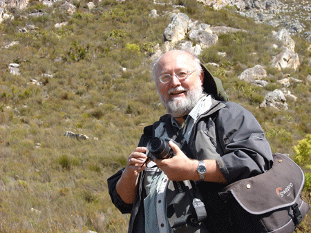
Professor Laco Mucina is leading a project to map biomass for improved fire management in the north Kimberley. Credit: Curtin University
|
The researchers will identify potential fire fuel loads and sources of greenhouse gas emissions, and then develop maps to provide a better understanding of vegetation and fuel types present. The mapping will combine satellite imagery analysis and fieldwork, including field data collected by traditional land owners.
Project leader, Professor Laco Mucina, said early European colonisation and disruption of traditional fire-management practices has resulted in a shift from cool and patchy early dry season burning to larger and more destructive late-season fires, which leave fewer unburnt refuges.
‘This has harmful effects on biodiversity and cultural sites, and results in the release of more greenhouse gas than would be the case under a milder fire regime,’ he says.
The project aims to facilitate the sale of credits for greenhouse gas abatement associated with reversing the fire management regime in the north-west: from large, destructive fires to a regime of smaller, milder fires.
Land managers and traditional owners will use the income generated by the sale of credits to employ rangers, who will undertake the required burning in a culturally and environmentally sensitive manner.


