Published: 11 January 2012
Managing the future of the north’s aquatic biodiversity
Bradley J. Pusey
Northern Australia features prominently in visions for Australia’s future. Plans for capturing, storing and transporting the region’s water to make it available for increased agricultural development in the region and elsewhere are frequently proposed. But what is our current understanding of the biodiversity, and the ecological functions and services and of the northern region, and how might these assets be affected by such development?
|
|
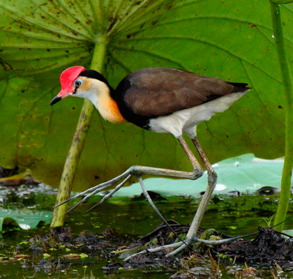
A comb-crested Jacana, one of the 30 per cent of the nation’s waterbird species that are recorded in the northern region. Credit: With permission of MV Jackson
|
The recently published book, Aquatic Biodiversity in Northern Australia: patterns, threats and future, by the Tropical Rivers and Coastal Knowledge (TRaCK) research consortium, examines the biodiversity of northern Australia’s freshwater ecosystems, its dependency on the natural water regime and how increased water use might be managed to avoid future degradation of the region’s sensitive ecology.
TRaCK is comprised of leading tropical river researchers from five Australian Universities (Charles Darwin University, University of Western Australia, Griffith University, Australian National University and James Cook University), federal research organisations (Geoscience Australia, eriss, AIMS, CSIRO), State governments of Queensland, Western Australia and the Northern Territory, and the Northern Australian Indigenous Land and Sea Management Alliance (NAILSMA). More than 30 researchers from TRaCK contributed to the book.
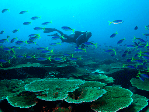
Northern Australian freshwater ecosystems sustain a very rich and distinctive biodiversity. Although it comprises only 17 per cent of the continent’s land area, the region contains a large proportion of the nation’s aquatic plants and animals.
For example, waterbird diversity accounts for about 30 per cent of the nation’s waterbird species, whereas freshwater fish account for almost 60 per cent. A third of the nation’s frog species, and half the turtle species, are also found in northern Australia, as are many water dependent lizards, snakes and of course, crocodiles.
|
|
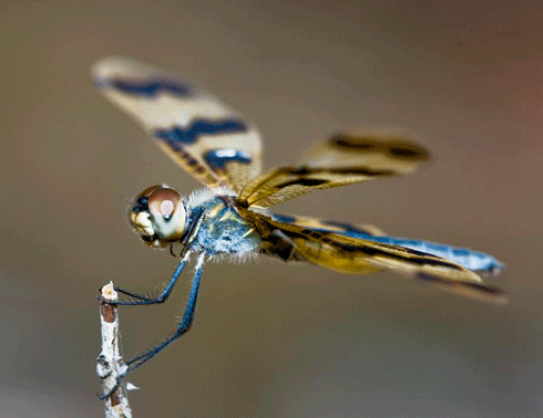
A graphic flutterer (Rhyothemis graphiptera). Credit: With permission of J Clark
|
Such high biodiversity is perhaps not surprising as the region’s freshwater ecosystems sit within a savanna landscape of globally significant ecological integrity1.
Moreover, northern Australia contains the highest concentration of free-flowing rivers in the world2. Consequently, the biological systems of northern Australia’s swamp, wetlands and rivers remain relatively pristine and capable of supporting such biodiversity riches. Importantly, the connectivity of different parts of the riverine landscape (for example, headwaters, main channels, floodplains and estuaries) and between the riverine and near-shore marine environment, remains largely intact across the region, allowing the free passage of organisms, nutrients, carbon and energy necessary to sustain high biodiversity.
|
|
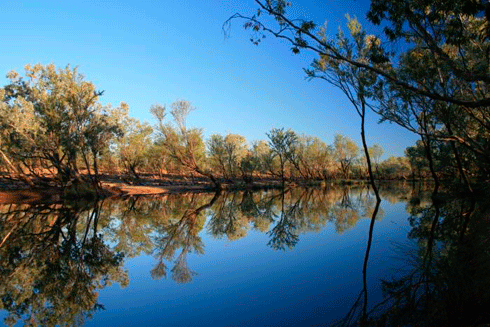
A view across the majestic Hann River in the Fitzroy River catchment (Western Australia). Credit: TRaCK
|
“Hot-spots” of biodiversity vary between taxanomic groups, making effective conservation and protection measures difficult. The national reserve system currently does not adequately cover the distribution of all aquatic biota. For example, up to 80 per cent of all species examined had less than 5 per cent of their total distribution contained within existing protected areas.
Also of significance is the high rainfall of the region – more than 1 million gigalitres per year! This means that the area’s rivers transport huge volumes of water. The Mitchell River in Queensland, for example, conveys an average of 24 000 megalitres a day, more than any other river in Australia.
Such high flows and abundant rainfall also mean a great diversity of aquatic ecosystem types, across a huge area. For example, floodplain wetlands are so vast that they may cover about 25 per cent of the catchment area of some basins. They are hotspots of biological production which is later transported widely throughout river systems and is, therefore, of enormous ecological, cultural and economic significance.
|
|
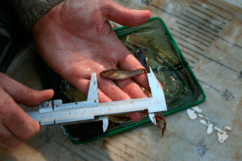
Measuring fish during fish surveys on the Daly River, Northern Territory. Credit: TRaCK
|
However, despite the huge amount of rainfall, it is highly seasonal and often unpredictable in incidence and volume. Most of northern Australia incurs an annual water deficit (rainfall minus evapotranspiration) of about 1000mm. This places extreme pressure on the region’s biota and greatly limits production. Most rivers cease to flow, often for periods of up to nine months, and contract back to series of isolated refugial waterholes. Such large contractions in available aquatic habitat constrain the development and maintenance of high biodiversity.
In intermittent rivers (the dominant river type across the region), aquatic species are either forced to retreat to these refuges, which become increasingly less hospitable as the dry season progresses, or seek shelter underground. Refugial waterholes often persist only when in contact with shallow groundwater.
|
|
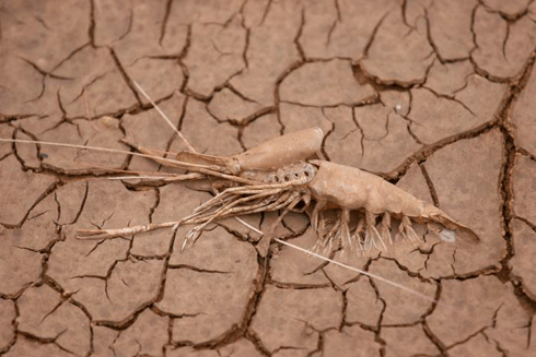
A prawn shell on cracking clay, Fitzroy River, Northern Territory. The northern region is characterised, and tested, by extremes of wet and dry. Credit: TRaCK
|
Groundwater is also critical in sustaining high levels of biodiversity in larger rivers. For example, the highest levels of fish biodiversity are found only in those rivers that have perennial flow sustained by groundwater contributions during the dry season (for example the. Daly, Mitchell, Wenlock and Jardine rivers).
Groundwater resources have been identified as suitable for development and exploitation in order to support agricultural expansion. The 2009 Northern Australia Land and Water Science Review3 suggested that further development of agriculture in northern Australia would most likely be of a mosaic style, where agriculture would be confined to areas defined by the coincidence of suitable soils and exploitable groundwater.
|
|
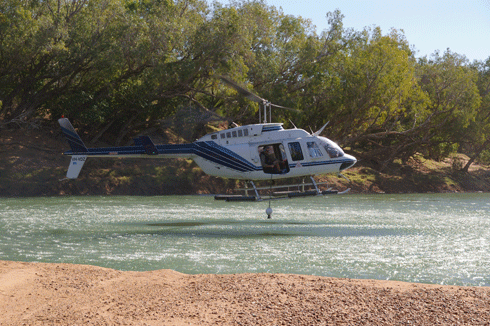
A helicopter being used by TraCK researchers to rapidly collect water samples from a remote area of the Fitzroy River, Western Australia Credit: TRaCK
|
Such a development option is less likely to have negative impacts on freshwater biodiversity than broad-scale agriculture and large-scale water capture and diversion schemes, which are sometimes proposed.
A greater focus on sustainable use of resources and a greater appreciation of the values of aquatic biodiversity from economic, cultural and spiritual perspectives suggest that alternative visions for the future of northern Australia are gaining traction. These visions recognise that the economic value from commercial fishing, recreational fishing and tourism more generally, is significant.
Similarly, the substantial dependence of Indigenous household economies on riverine production (for example fish, crustaceans, and birds etc. are used for food), represents another, significant form of economic value.
Combined with the central cultural and spiritual importance of the region for Indigenous peoples (about 60 per cent of the population), this multiplicity of values require that the maintenance of healthy aquatic ecosystems and the rich and productive biodiversity they sustain is key to a sustainable future for the north.
|
|
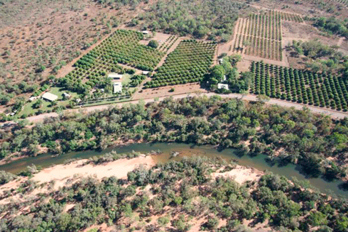
Horticultural development on the Daly River, Northern Territory. Credit: TRaCK
|
A set of guiding principles for improved management of aquatic biodiversity was proposed by the book’s authors. These are:
-
Prioritise and protect high value aquatic ecosystems;
-
Address current threats;
-
Explore development options and their consequences carefully;
-
Improve planning processes to secure environmental water allocations;
-
Improve the available information base; and
-
Improve public awareness and engagement.
Although visions of the future are useful, a clear focus on the present is critical. Aquatic systems across the north are currently threatened by feral animals (including pigs, buffalo, and alien fishes), weeds, altered fire regimes and a range of other diffuse pressures including resources extraction. We need to urgently and efficiently develop counter measures to these immediate threats to limit further and potentially widespread degradation of the region’s unique riches, and to ensure its broader values and future are assured.
Bradley J. Pusey is a researcher at the Tropical Rivers and Coastal Knowledge (TRaCK) research consortium, and editor of Aquatic Biodiversity of Northern Australia: patterns, threats and future. 2011. Charles Darwin University Press, Darwin.
1 Woinarski J, Mackey B, Nix H, and Traill B. 2007. The Nature of Northern Australia: Natural Values, Ecological Processes and Future Prospects, ANU E Press, Canberra.
2 Vörösmarty C J, McIntyre P, Gessner M, Dudgeon D, Prusevich A, Green P, Glidden S, Bunn S E, Sullivan C, Reidy C, and Davies P M (2010). Global threats to human water security and river biodiversity. Nature 467:555–561.
3 Stone P. (2009). Northern Australia Land and Water Science Review. Final report to the Northern Australia Land and Water Taskforce, CSIRO Publishing, Canberra.