Published: 17 January 2013
Crunch time for metals recycling?
Alex Serpo
With the world facing a rare-earth metals crisis, a paper published in the leading journal Science last year examined how far we are from cradle-to-cradle metal recycling, and identified future constraints and opportunities.
|
|
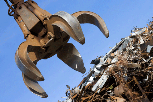
End-of-life recycling rates for commonly used metals such as iron, copper, zinc and lead are above 50 per cent. However, rare earths and other lesser known metals are seldom, if ever, recycled. Credit: © rihardzz/istockphoto
|
In the paper, ‘Challenges in metal recycling’ written by US researcher, Barbara Reck, the author identifies a modern paradigm shift in metals use – today, humans exploit virtually every stable element in the periodic table.
In other words, we are now capitalising on every element’s unique physical and chemical properties, whereas for most of human history, we utilised only a handful of metals.
Another modern shift is that of recycling, a ubiquitous aspect of modern life. ‘The generation between 20 and 30 are now the first generation to have grown up with recycling bins as part of normal life,’ writes Reck from Yale University's Center for Industrial Ecology.
Reck adds, however, that the extent of modern metals recycling is well below potential.
'Metals are infinitely recyclable in principle. But in practice, recycling is often inefficient or essentially nonexistent because of limits imposed by social behaviour, product design, recycling technologies, and the thermodynamics of separation.'
She identifies two metrics that provide the most accurate measures of the rate of metals recycling – 'recycled content' and 'end-of-life recycling rate'.
Recycled content describes the share of scrap in metal production, which is important to get a sense of the magnitude of secondary supply. End-of-life recycling rate, on the other hand, is defined as the fraction of metal in discarded products that is reused in such a way as to retain its functional properties.
The paper makes reference to a United Nations’ panel that recently defined and quantified recycling rates for 60 elements. Two key trends are clear from this research.
The first is that end-of-life recycling rates for the commonly used base metals such as iron, copper, zinc and lead are above 50 per cent.
The second trend is that many trace elements are seldom, if ever, recycled. Most of these trace elements are increasingly used in small amounts for very precise technological purposes, such as red phosphors, high-strength magnets, thin-film solar cells, and computer chips.
In those applications, often involving highly comingled 'specialty metals', recovery can be so technologically and economically challenging that the attempt to recycle is seldom made.
'After millennia of products made almost entirely of a handful of metals, modern technology is today using almost every possible metal, but often only once. Few approaches could be more unsustainable,’ comments Reck.
|
|
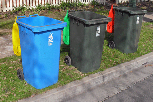
Greater opportunities for collecting used metals have improved recycling rates over recent decades. |
In her paper, Recki identifies lead as a notable exception : '...80 per cent of today’s lead use is for batteries in automobiles and for backup power supplies, and collection and pre-processing rates from these uses are estimated to be within 90–95 per cent as a result of stringent regulation worldwide. The result is a nearly closed-loop system for lead use in batteries.'
While improved product design and enhanced deployment of modern recycling methodology will both improve recycling rates, Reck identifies one activity that stands out as the key to increasing recovery.
'It seems mundane at first telling, but the activity with the greatest potential to improve metal recycling is collection,' she writes. 'Much improvement is possible, but limitations of many kinds – not all of them technological – will preclude complete closure of the materials cycle.'
Reck also identifies a perverse incentive when it comes to product design for recycling: the more advanced and highly engineered the product, the more difficult it is to recycle. This is particularly true for electronics products, but also applies to other goods like cars, aeroplanes and whitegoods.
|
|
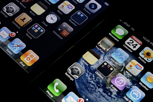
Collectively, today’s high-tech products make use of almost every metal, in contrast to earlier products that used only a handful of the more common metals. |
The paper identifies another paradox of modern materials recovery. 'It is not much of an exaggeration to say that we manufacture modern products with the best possible technologies we can devise, but generally recycle them with relatively basic approaches.
'It is unfortunate from a materials perspective that, for reasons of scale and economics, often only the more basic technologies (shredding, crushing, magnetic sorting) are routinely applied, whereas more advanced technologies (such as laser, near-infrared, or x-ray sorting) are limited to selected recyclate streams.'
The paper dismisses the common notions of infinite recyclability for bulk recycling of common metals.
'Markov chain modelling shows that a unit of the common metals iron, copper, or nickel is only reused two or three times before being lost, gainsaying the notion of metals being repeatedly recyclable.'
Reck’s concluding comments identify how materials substitution could help improve the sustainability of metals supplies.
'Sometimes, scarce metals can be replaced by more common metals with only modest loss of product performance. Examples are aluminum-doped zinc oxides substituting for indium tin oxides in liquid crystal.’
This is a lightly edited version of an article that first appeared in Business Environment Network (BEN) and is reproduced with permission.