

|
Published: 11 December 2012
Breaks in the surf zone point to future shores
Australia’s beaches and shorelines are continually changing with varying wave conditions and sea level – changes that will be more pronounced with sea level rise and other global warming impacts. CSIRO oceanographers are using radar and video cameras to monitor changes at Secret Harbour beach, south of Perth.
|
|
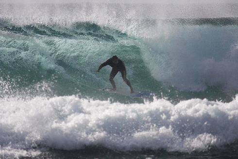
Surfer at a WA beach: surfers are keen observers of changes to beaches and surf breaks. Credit:
rooracer/flickr under Creative Commons CC BY-ND 2.0 licence
|
The project is part of Australia’s ocean forecasting system, BLUElink, a joint initiative of CSIRO, the Bureau of Meteorology and the Royal Australian Navy, that aims to provide forecasts of ocean currents and eddies, and surface and subsurface ocean properties.
‘Ultimately, we are trying to build a capability to forecast changes in surf zone sand bars and gutters as sea, wind and wave conditions change,’ says CSIRO’s Dr Graham Symonds.
Regular beach goers will be familiar with changes in beach shape and shoreline position – for example, erosion following storms, or rocky sections exposed during winter and covered with sand during summer. Long term residents may be aware of progressive changes in their local beach over periods of many years.
‘In the face of changing sea level, the effects of potential inundation and coastal erosion will continue to be a focus of coastal councils and communities for the foreseeable future,’ explains Dr Symonds.
‘Our intention is to harness the data we are acquiring here at Secret Harbour and construct a computer model capable of predicting beach shape and shoreline position under the full range of wave conditions.
‘There’s an immediate application for this research by the Royal Australian Navy with amphibious landings, however it can also be applied to improve beach safety, monitoring coastal erosion and understanding of how beaches might respond to climate change.’
Secret Harbour beach was chosen because it is a relatively straight beach that is typical of some of the Perth metropolitan beaches. In an experiment running since May 2011, the CSIRO science team has constructed a beach tower, installed a radar system, in-water current meters and pressure sensors, and a video camera system, focusing on an area of beach about 1 km long and extending offshore about 500 m.
‘Waves break over shallow sandbars so video and radar observations of breaking waves provide a measure of the underlying bathymetry. Gaps in the surf zone are associated with deeper water where the waves don’t break and often indicate the location of rip currents,’ explains Dr Symonds.
He says the laptop-based ocean modelling system for the surf-zone will provide wave and current forecasts several times a day for use by the Royal Australian Navy, and will also be relevant for rescue agencies, environmental protection and recreational marine activities such as fishing and surfing.
The project will help develop a core capacity in wave and near-shore dynamics comparable with that available in ocean and atmosphere dynamics in Australia.
Source: CSIRO

